Our Geomatics team provides an invaluable part of the service we offer to our clients; we are involved with projects from the very beginning, identifying landowners and land types prior to any engagement, up to the point of formulating legal documents and providing accompanying legal plans for deeds, tenancies and CPO’s.
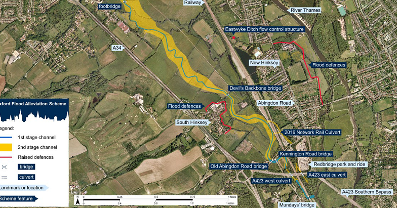
Dalcour Maclaren was instructed to assist with a Flood Alleviation Scheme which covered around 5km of residential, agricultural and commercial properties. Once completed the scheme will consist of a combination of flood channels, embankments, bunds, walls, gates and control structures, alongside planned reinforcements of the existing structures along the route.
Dalcour Maclaren was tasked with providing information for the Compulsory Purchase Order (CPO) including the production of the Book of Referencing and lands plans.
Our Geomatics team referenced every land parcel across the scheme, identifying ownership through HMLR data sets, as well as highway extents, existing utilities and special category land. We worked with the client to continually cross-reference the proposed routes with landownership boundaries to streamline stakeholder engagement.

The information we generated was then provided to the client for use in the Book of Reference along with subsequent plans which were created from CPO ‘land plots’ with the use of ArcGIS software.
When it came to the service of notices we were also able to use our innovation by developing a mobile app to plot the location of CPO site notices and record the monitoring of these notices over the statutory 4-week period defined by the Order.
Throughout the CPO the team, alongside our surveyors and the client team, consistently contributed to the smooth running of the project, ensuring accuracy, efficiency and cost-effectiveness across several parts of the scheme.
Sector
Water
Location
Oxford
How we helped
CPO Land Referencing & Data Management
Get in touch


