CONNECT, our bespoke project management system is designed in line with our internal methodologies to facilitate the progress of all schemes from helpdesk calls to Nationally Significant Infrastructure Projects.
CONNECT’s spatial database enables the visual presentation and analysis of land parcels and interested parties via easy-to-use online maps and dashboards and integrates with our WebGIS. It incorporates an industry-leading land referencing capability ensuring data stems from a single source of truth.
- Transparent and collaborative working within DM, with clients and across wider project teams
- Effective project management through tasks, risks and actions
- Documents, emails, notes and all project information stored in a central, secure and accessible cloud location
- Document management and version control in a multi-user environment
- Linking documents, emails and notes to land parcels and interests to provide a complete, searchable and traceable ‘project file’ to meet our legal due diligence requirements
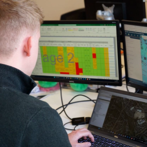
- Statistical reporting through dashboards of RAG (Red Amber Green) status of parties, parcels, titles & groups
- Geographical reporting by location, by landowner, by administrative boundary, by project areas
- Secure data sharing in a GDPR compliant manner

“CONNECT is integral to all our projects and access is readily available to our clients on a value-added basis."
Tim Donoyou, Associate Director, Dalcour Maclaren
Related Case Studies